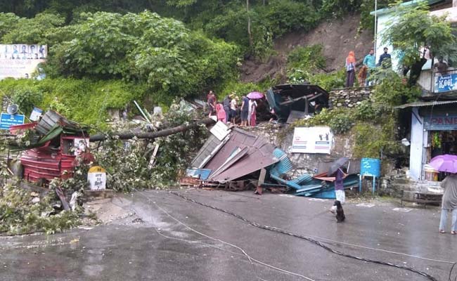
Rains lashed many places in Uttarakhand on Sunday, triggering landslides that blocked several roads, even as the Ganga crossed the danger mark in Devprayag and the warning level in Haridwar due to heavy release of water from the dam on the Alaknanda river.
According to officials, the Ganga was flowing at 463.20 metres following which water filled up in Sangam Ghat, Ramkund, Dhaneshwar Ghat and Fuladi Ghat. There was also a tremendous jump in the water level of the Ganga after 2,000-3,000 cusecs of water was released from the dam of the GVK hydroelectric project built on the Alaknanda river.
Tehri District Disaster Management officer Brijesh Bhatt said the district administration is making frequent calls to warn people to stay away from the banks of the river. He said the water level of the Ganga in Muni ki Reti area of Tehri near Rishikesh also increased to 339.60 metres, which is 0.10 metre above the warning level of 339.50 metres.
Officials said the Ganga crossed the warning level of 293 metres and reached 293.15 metres in Haridwar Sunday evening, adding that an alert has been issued in the low-lying areas due to the increased level of the river.
The State Disaster Operation Centre has directed Haridwar District Magistrate Dheeraj Singh to repair Gate No 10 of the Bhimgoda barrage at the earliest to avert any heavy losses due to the high-speed water flowing through the breached gate.
A flood-like situation is prevailing in 71 villages of Laksar, Khanpur, Roorkee, Bhagwanpur and Haridwar tehsils due to incessant rains in the past few days.
The rescue and relief operations are being carried out with the help of the National Disaster Response Force (NDRF), State Disaster Response Force (SDRF), army and state police.
The abutment of a bridge on the Joshimath-Malari road was damaged due to debris and excess water flowing into the Girthi Ganga river at Niti Ghati in Chamoli district’s Joshimath, they said.
According to the disaster management department, this bridge was only used by the Army and the Indo-Tibetan Border Police.
The Dehradun Meteorological Centre has issued an ‘orange’ alert, warning of heavy rain, in all 13 districts of Uttarakhand on Monday.
An ‘orange’ alert is issued as a warning for extremely bad weather with the potential for disruption in commuting with road and drain closures and interruption of power supply.
Meanwhile, the water level of the Kali river in Pithoragarh’s Dharchula area is also flowing above the warning level of 889 metres.
In Roorkee, Bhagwanpur, Laksar and Haridwar tehsils, 3,756 families have been affected in 71 villages. Of these families, 81 have been shifted to relief camps, they said.
Five people have died in these areas due to the floods. Seven houses have been completely damaged and 201 suffered partial damage. Seventeen roads and nine bridges have also been damaged due to the heavy rains in Haridwar, they added.
At 70 mm, Kapkot received the maximum rainfall in the state in the last 24 hours, according to the State Emergency Operation Centre.
Mussoorie received 61 mm rainfall, Karnprayag 57 mm, Chamoli 54.4 mm, Nagthat 53 mm, Mohkampur 48 mm, Vikasnagar 41 mm and Uttarkashi 39 mm.
The officials said 2,000-3,000 cusecs of water was released from the Srinagar Hydro Electric Project dam in Pauri district as the Alaknanda river was flowing above the warning level, the officials said.
The State Emergency Operation Center has instructed the district magistrates of Tehri, Pauri, Dehradun and Haridwar to take necessary precautions, they said.
(Except for the headline, this story has not been edited by NDTV staff and is published from a syndicated feed.)


